
Topographical Surveys
Get in TouchAt Land Survey UK, we specialise in topographical surveys, providing accurate mapping services across . Our surveys record the natural and man-made features of the land, essential for planners, architects and engineers during any development project.
We use advanced equipment to capture details like elevations, boundaries and infrastructure, ensuring precision and compliance with industry standards. Covering and the surrounding postcode area, our team is dedicated to delivering timely and reliable results for all types of landscapes.
Get in touch to arrange a site survey today.
What Is a Topographical Survey?
A topographical survey is a mapping service that defines the contours and features of a plot. At Land Survey UK, we conduct detailed assessments that identify elements like terrain, vegetation, and structures.
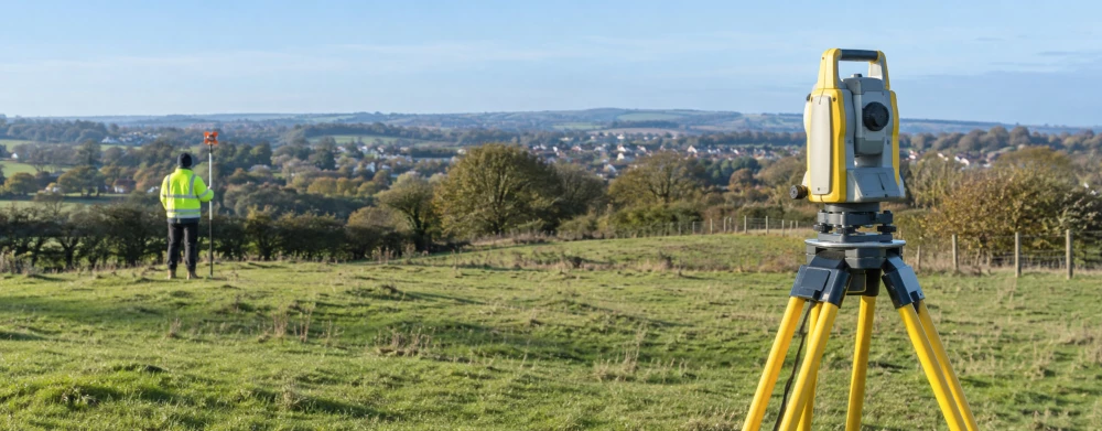
We use equipment such as total stations, GPS, and laser scanners to map each feature meticulously and ensure accuracy. Our surveys also capture infrastructure elements such as drainage systems, utility locations, and boundary lines, which are crucial for site planning.
Detailed data is presented through CAD drawings, providing architects, engineers, and planners with actionable insights for developments.
We adhere to industry standards such as RICS guidance, ensuring our surveys meet the necessary accuracy and detail levels required for regulatory approval and efficient project planning. Our topographical surveys also cater to environmental consultants needing precise data on natural features.
We invite clients to contact us for more information on how our services can benefit their projects.
How Much Does a Topographical Survey Cost?
Topographical surveys typically cost between £500 and £2,000. The specific price depends on the size and complexity of the site, as well as the level of detail required.
Factors affecting pricing include terrain type, site accessibility, and the presence of intricate features like vegetation and water bodies. For instance, a wooded area needing tree mapping might require additional resources and time.
We use advanced equipment such as total stations and GPS units to ensure precise measurements. For sites with significant elevation changes, additional survey points may be needed, affecting costs.
Clients such as property developers and construction companies often seek surveys to aid planning and ensure compliance with local regulations. Contact us for a detailed quotation that considers your unique project needs and provides an accurate forecast.
Get a Free Topographical Surveys Quote
Why Choose Land Survey UK for Topographical Surveys?
Choosing Land Survey UK for your survey needs ensures accuracy and reliability. Our skilled professionals use tools such as 3D laser scanners and Total Survey Stations to capture comprehensive data with precision.
We adhere to the RICS guidelines, ensuring all surveys meet industry standards.
For diverse projects, our team assesses factors like land contours, existing structures, and utilities. We efficiently map areas for residential developers, commercial properties, and public infrastructure projects.
Our surveys typically include features like boundary lines, vegetation, elevation points, and drainage systems to aid in informed planning and construction.
We pride ourselves on delivering precise results promptly, often concluding surveys within two to three weeks depending on project scope, fostering trust with our clients. Our expertise spans a variety of environments, from urban developments to rural sites, making us a versatile choice.
Get in touch for guidance on your specific survey requirements.
What Types of Topographical Surveys Are Available?
We offer a variety of topographical surveys to meet different project demands:
Basic Survey: Captures essential features such as boundaries, contours and main structures. This survey is ideal for preliminary assessments and concept planning, using tools like total stations and GPS equipment to ensure accuracy.
Detailed Survey: Includes minor features, services like drainage, and smaller landscape elements. This survey is perfect for projects requiring in-depth information, such as urban development or landscaping, often adhering to standards like Ordnance Survey accuracy for precise data.
Construction Survey: Provides additional data for site layout and design purposes. These surveys are crucial during construction phases, offering precise data for foundation setting and alignment tasks. We use laser scanning for thorough measurements and analysis.
Each type ensures that the necessary details are recorded, tailored to the particular project's scope and scale. Contact us to discuss the topographical survey best suited for your needs.
How Long Does a Topographical Survey Take?
Most topographical surveys are completed within two to five days. This timeframe varies based on the site's size and complexity, as well as weather conditions and accessibility.
For larger sites or those with intricate features like sloped terrains or dense urban environments, the survey may take closer to the higher end of this range. Our team uses Total Stations and GPS equipment to collect precise elevation and feature data, complying with RICS standards for accuracy and reliability.
In addition to on-site data collection, we conduct thorough data processing back in our office using specialist software like AutoCAD Civil 3D, producing detailed 2D and 3D maps. After data collection, clients receive processed survey results within a week, ensuring no delays to planning or construction schedules.
By streamlining our processes, we maintain efficient turnaround times. Contact us to schedule your survey and receive a timeline for your project.
What Are the Benefits of Topographical Surveys?
Topographical surveys provide numerous benefits, offering essential data for successful project completion. These surveys involve the use of total stations and GPS technology to capture detailed measurements of land elevations, contours, and natural and man-made features.
This data is essential in creating precise 3D models, which are invaluable for architects and engineers during the planning stages.
Improved Planning: Understanding the land's features aids in effective design decisions. Knowing the precise location of utility lines and environmental factors helps in optimising layouts and minimising disruption.
Risk Mitigation: Identifies potential challenges like gradients or drainage issues. Detecting flood-prone areas early can save costs and prevent future structural problems.
Accurate Documentation: An essential tool for legal, boundary and construction records. Topographical surveys ensure compliance with industry standards like the RICS specification for surveys and mapping.
These benefits make topographical surveys a vital part of any planning or development strategy, ensuring projects are both efficient and sustainable. Consider contacting us today to discuss your requirements.
Speak to Our Topographical Surveys Team
Frequently Asked Questions
What equipment do you use for topographical surveys?
We typically use equipment like 3D laser scanners, GPS units and Total Survey Stations for topographical surveys. This technology ensures precise measurement and mapping of all site features.
Are topographical surveys required for planning permission?
While not mandatory, topographical surveys can significantly improve planning applications by providing detailed land data, which supports decision-making and compliance with local regulations.
How do I book a topographical survey with Land Survey UK?
To book a topographical survey, simply get in touch with our team. We'll discuss your project needs and arrange a convenient date for the survey.
Call us for more assistance.
What areas do you cover?
We cover , including the postcode area. Our team is ready to assist with projects of any size across various locations.
How are the survey results presented?
We provide survey results as detailed digital maps and PDF reports, offering a view of the site's features, allowing for easy integration into design plans.
Get a Free Quote for Topographical Surveys
Contact Land Survey UK today to discuss your topographical survey requirements. Our experienced team is ready to provide you with an accurate and detailed site assessment.